Driving the Dempster Highway
What we learned driving the Dempster Highway from Dawson City to Tuktoyaktuk — prep, staging, the road itself, camping, safety, and the spectacular scenery and rich geological heritage.

Jump to section
Getting there
Getting to the Dempster is an adventure in its own right. We came up from Calgary through northern BC and into Yukon, and there’s plenty worth stopping for on the way. Although you can drive for 8-10 hours a day, it will make the trip an expensive stress-fest, so if you have the time, it’s worth slowing down and appreciating the journey.
If you’re coming up from the south you’ll be on the Alaska Highway — the Alcan — for a good stretch, which has real history behind it. We picked up a copy of the Milepost, which is the definitive mile-by-mile guide to northern highway travel. It took us a bit to figure out how to read it, but once we did it was invaluable and pretty good entertainment, keeping the copilot engaged while each of us took turns to drive.
Mobile coverage thins out as you head north — plan accordingly. Bring a Starlink: it provides wifi on the go, and most phones can make emergency calls over wifi when there’s no cell signal.
Dawson City
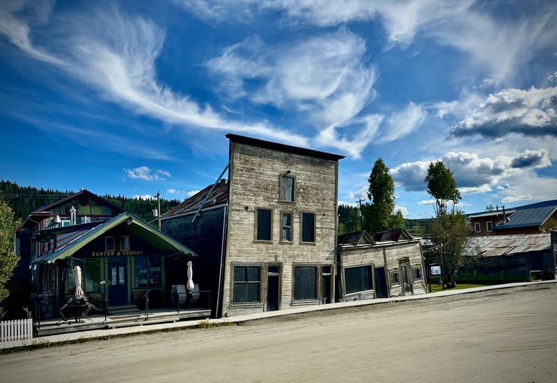
Dawson is the obvious staging point for the Dempster. You actually drive past the Dempster turnoff to get there, and most people spend a night or two there. We spent a couple of nights on the way up, and one on the way back.
Dawson is the center of the Klondike Gold Rush of 1896 and a lot of the original buildings are still standing. The population massively exploded over the course of two years, with prospectors and adventurers (and neer-do-wells!) coming up from California to try to make their fortune. It’s an interesting place and worth spending a couple of days rather than just one night.
Staying: The downtown campground is essentially a parking lot, but it’s fine. You’re walking distance to everything and there are showers and laundry on site. There’s a Parks Canada campground across the river that’s nicer, but even if you time the ferry perfectly you’re adding 30+ minutes each way to downtown. We stayed downtown.
Doing things: The Sour Toe Cocktail is exactly what it sounds like and a Dawson City institution. You should do it — you get a certificate, which is the first of several you can collect on this trip if you’re that way inclined. The can-can dancers at Diamondtooth Gertie’s are worth an evening. If you like cocktails (real ones, not sugary hotel-bar crap), go to Bombay Peggy’s — it’s a proper cocktail bar and a bit of a hidden gem.
Starting the drive
Top up your fuel and water before you leave Dawson City. For water, Inuvik is the next reliable fill. Our tank lasts for about five days of normal use, so two fills covered the whole trip up and back without rationing. Bring a jerry can for fuel too; you might not need it, but it could help you help someone else. ATMs thin out north of Dawson, so carry cash.
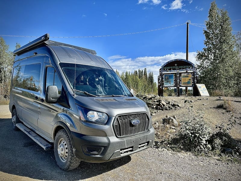
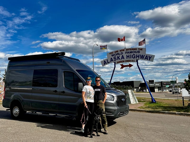
There’s a sign right at the Dempster junction that’s a classic photo op. Stop here, take the picture, and air down your tires before you hit the gravel.
Then you’re across the blue bridge over the Klondike River and onto gravel. It feels like a proper departure.
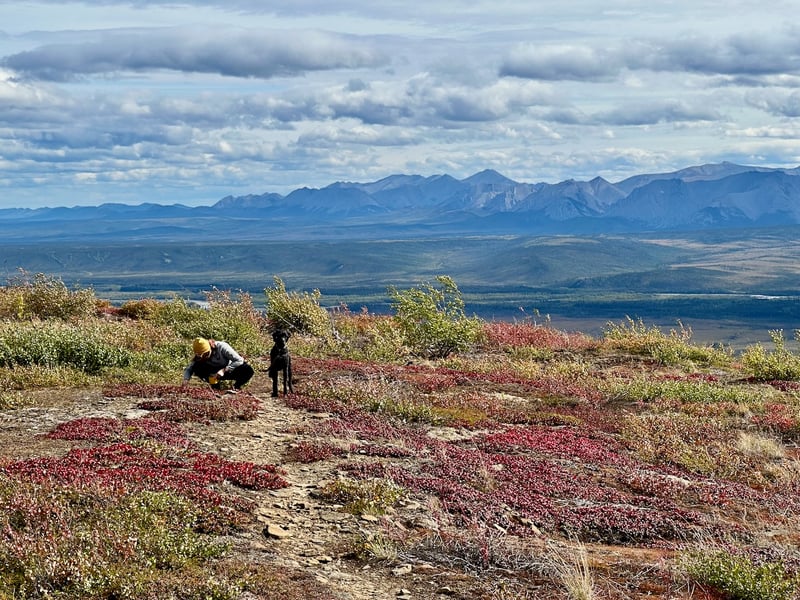
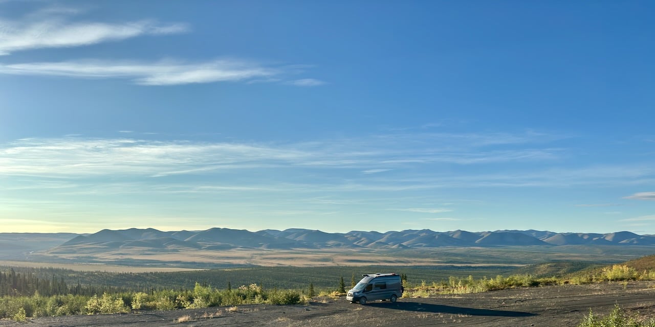
One thing worth paying attention to from the start: the landscape changes constantly as you go north. Boreal forest near Dawson gives way to shrub tundra, then open Arctic tundra, then eventually nothing but low moss and lichen all the way to the ocean. The vegetation isn’t just scenery, it’s a record of permafrost, climate, and the limits of where trees can survive. The geology shifts too, and watching for patterns can while away the miles.
Tire pressures
Air down before starting out on the Dempster, but don’t go as low as you would for a forestry road. The road has sharp shale and you’re travelling at higher speeds than typical off-road — too little pressure and you’re in danger of getting a sharp rock in the sidewall. We ran KO3 off road tires with an E load range and had no issues.
Our pressures are calculated from our actual axle weight cross-referenced against a load chart, yours will be different. But the pattern is what matters:
| Scenario | Front | Rear | Notes |
|---|---|---|---|
| Highway – normal load | 50 psi | 60 psi | Half tank water, standard gear |
| Highway – full load | 52 psi | 70 psi | Full tanks, full gear, near GVWR |
| Gravel / backroads | 40 psi | 45 psi | Lower pressure improves traction and ride |
| Dempster Highway | 45 psi | 50 psi | Higher speeds, sharp shale — split the difference |
The Dempster sits between highway and backroads — lower than tarmac, but not as low as a slow forestry track.
Big truck etiquette
There are serious trucks on this road: supply vehicles, fuel tankers, and in summer, house haulers. Prefab housing is common up north because building materials and tradespeople are so expensive to source locally, so they build a house in two halves somewhere south, load it onto a wide-load truck, and drive it to Inuvik or Tuktoyaktuk to reassemble. We passed several of these. Two trucks, half a house each. If you see one half coming at you, the other half is likely right behind it.
The rule for big trucks is simple: either drive faster than them (unlikely!) or pull over and let them past. We pulled over a lot. They were generally decent — the odd cowboy, but mostly sensible and respectful.
For oncoming big trucks: pull over and stop. This reduces the speed at which their gravel is coming at you. We had essentially no damage — maybe one windshield chip — but we’ve seen what happens to other vehicles that didn’t.
Consider rock stoppers, and tape the leading edges of your windows — especially frameless ones. A rock to the edge can shatter a frameless window; tape absorbs enough of the impact to make a difference.
What vehicle do you need?
Probably whatever you already have. We saw built 4x4 rigs, minivans, motorcycles, a Cybertruck, and a convoy of classic Mustangs making it up to Eagle Plains for a laugh. The Dempster is a gravel road, not a rock crawl.
The things everyone had in common: at least one good spare tire, and something more rugged than street rubber. We ran BFG KO3s with a full-size spare. We also carried fix-a-flat and a proper ARB tyre repair kit — Taylor learned to use one at an ARC Offroad training class, which we’d highly recommend.
We drove at a sensible speed, aired down a bit, and didn’t get a flat. Others weren’t so lucky — though we have no idea how fast they were going.
Driving on the Dempster
Conditions change dramatically from one stretch to the next. Some sections are smooth enough that you’ll be able to get up to 80 or 90 km/h, others will slow you to 30 for a run of washboard, or a set of potholes that appear immediately after a stretch that felt fine. This is normal. Variable speed is just how the road works.
Cruise control is actively harmful here. The surface changes too fast, and the smooth sections are exactly where the Dempster catches you out — you relax, and then there are potholes. You want the reflex of your foot coming off the accelerator to slow the vehicle — cruise control gets in the way of this and adds reaction time.
It’s not a race. Whatever Google Maps says your travel time will be, add a significant margin, like double.
The Dempster is constructed as a large gravel ‘mound’ over the permafrost. It was actually built in the winter, and the highway insulates the permafrost and keeps it frozen in summer. As a result, the sides of the road are serious dropoffs — not dangerous if you’re paying attention, but not something to toy with. It’s a road that requires your attention.
If you pass someone pulled over who doesn’t look like they’re just taking a break, stop and check on them. They are probably fine but will appreciate you having checked in.
The road is treated with a dust suppressant, and when it rains that chemical mixes into the mud and dries into something closer to cement than ordinary dirt. We got lucky — our trip was mostly dry — but we passed vehicles coming south that were caked from bumper to roof. There are wash stations in Inuvik and Dawson City, but they’re water only, so don’t expect to get it properly clean for a while. The mud seemed to come off our paint without too much trouble, but our spare tire is still caked, a year later, after multiple washes.
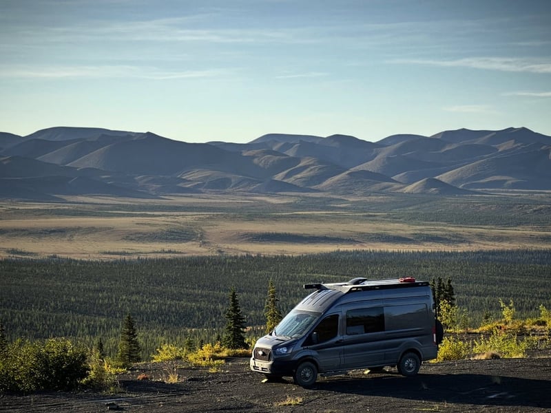
The scenery is spectacular the whole way. There’s a noticeable jump when you cross into the Northwest Territories. The landscape opens up, gets wilder, gets bigger. The wind does too. It’s serious wind, the high roof van was about as exotic a vehicle as I’d ever want to drive through that. NWT’s license plate says “Spectacular NWT” and we don’t disagree.
Tombstone Territorial Park
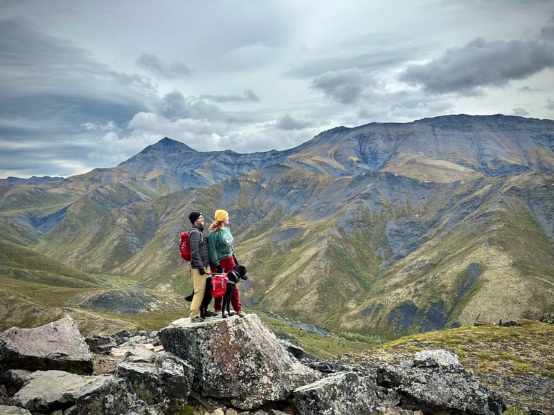
About 70 km in, you hit Tombstone Territorial Park. Stop here, you’ll kick yourself if you don’t.
The interpretive center hands out loaner ‘milepost’ guides to the entire Dempster, worth grabbing if they have one. The campground is decent and will almost certainly be full, in which case you join the parking lot camp-out, which has its own vibe. We had a good time meeting people and woke some of our new friends up at 3am for northern lights.
There are good hikes in the area. Worth a day if you have it.
Just past the interpretive centre, the highway reaches its highest point — around 1,400 metres — at North Fork Pass, which is the Pacific-Arctic continental divide. Everything south of that ridge drains via the Klondike into the Yukon River and eventually the Bering Sea. Everything north drains via the Ogilvie and Peel rivers to the Mackenzie and the Beaufort Sea.
If you’ve driven the Rockies, you’re used to a continental divide that splits east from west — it makes spatial sense. A divide that splits north from south takes a moment to process. If you came through Whitehorse on the way up and noticed the Yukon River running northward through town — which, to me is the ‘wrong’ way — that’s the same system. Rivers here don’t drain to the Pacific or Atlantic. They drain up through Alaska to the Bering Sea.
The mountains look like nothing south of here, and there are two reasons.
The first is the rock itself. The peaks are part of the Tombstone Plutonic Suite — Cretaceous intrusions about 93 million years old. They’re not ordinary granite; they’re syenite, which is silica-poor and alkali-rich, with a jointing pattern that produces sharp, blade-like ridges rather than the rounded domes you’d get from standard granite. That accounts for the darkness and the angularity.
The second is ice — or rather, the absence of it. This area was part of Beringia, the vast landmass connecting Russia to Alaska and the Yukon during the last ice age, and it escaped glaciation. The reason isn’t what you might expect: it wasn’t warm enough to avoid ice. It was too dry. Pacific moisture was cut off during glacial maxima, so the snowfall needed to build a glacier never accumulated. While the rest of Canada was buried under kilometres of ice, this patch of the Yukon stayed clear. Species that survived here did so because the conditions that killed everything elsewhere simply didn’t reach this far west. Tombstone sits near the eastern margin of that refugium.
The people who lived in Beringia left traces on what is now the floor of the Bering Sea. When the ice ended and sea levels rose, the land bridge drowned. Former riverbeds and lake basins are still visible in the seafloor topography, and researchers are beginning to map them — settlements would have clustered near water, so the underwater geography points to where to look. An entire chapter of early human prehistory may be sitting under the ocean.
Without glaciers to round and polish the peaks, the mountains have been shaped instead by relentless freeze-thaw: water works into rock joints, freezes, expands, and progressively shatters the rock along its fracture planes. On the ridgelines this produces vast spreads of angular shattered boulders — blockfields — with no glacial transport mechanism to move them anywhere. They just accumulate. You can see them from the trail.
One more thing if you’re hiking near the interpretive centre: some of the darker rock in the canyon walls is chert, formed from the silica skeletons of microscopic marine organisms called radiolarians. The rock is roughly 470 million years old. Geologists can identify individual fossil radiolarians in it under a hand lens. The ocean it formed in no longer exists.
Tombstone Rocks
The Yukon Geological Survey runs weekend geology hikes out of the park each August — they call it Tombstone Rocks — and it’s free. We went on two of them. The survey was actively working in the park at the time; the weekend program is how they engage with the public while they’re in the field. Going hiking with a dozen geologists turns out to be genuinely remarkable: they stop at rock faces, pull out hand lenses, point out things you’d walk straight past, and explain what you’re standing on in terms that actually stick. We’d strongly recommend it if the timing works out. Check the Yukon Geological Survey website for dates before you leave.
Ogilvie Ridge viewpoint
Between Tombstone and Eagle Plains there’s a pullout at the Ogilvie Ridge with a panoramic view across the mountains. Stop here. It’s one of those spots where you get out of the vehicle, take in the scale of what you’re looking at, and don’t say much.
The berries up here are worth foraging if you know what you’re looking for. Taylor topped up our blueberry supply considerably — we were going through them on granola and yoghurt every morning. Late August is on the late side of the season; earlier is probably better. Stick to spots well away from the road to avoid dust and chemical runoff.
Don’t forage anything you can’t positively identify. Taylor uses a field guide — if you’re not confident, leave it. Some berries up here look similar to things that aren’t edible.
Wildlife
The wildlife on the Dempster is worth keeping an eye out for throughout the drive, though what you see is largely luck and timing.
Ptarmigans were a highlight — fat little birds that look like pigeons if pigeons had evolved to be genuinely interesting. They have feathered feet and legs, which is exactly as good as it sounds, and they seem completely unbothered by vehicles. We stopped and watched them for a while.
Foxes turn up in the towns. They’ve figured out that people mean food scraps and they’re not shy about it — keep an eye out in Eagle Plains and Inuvik particularly.
Eagles are around, mostly spotted in passing: a shape on a branch, something circling above a ridge.
Canada’s largest caribou herd — the Porcupine herd, somewhere around 200,000 animals — ranges across the northern sections of the Dempster. We didn’t see them. Plenty of people don’t. But if you do, you’ll know about it.
Boondocking on the Dempster
This is one of the best boondocking roads in Canada, and half the strategy is running it twice. On the way north, drop a pin in Gaia GPS (or OnX Offroad, or whatever you use) every time you pass somewhere that looks like it might be good. By the time you’re heading south you’ll have a whole list to pick from — no decision fatigue, no settling for somewhere mediocre because it’s getting late.
What to look for:
Microwave towers. These are built high, which means access roads, which means views. They need regular maintenance and fuel deliveries, so the roads are usually driveable. We found one that was genuinely one of our best spots of the trip.
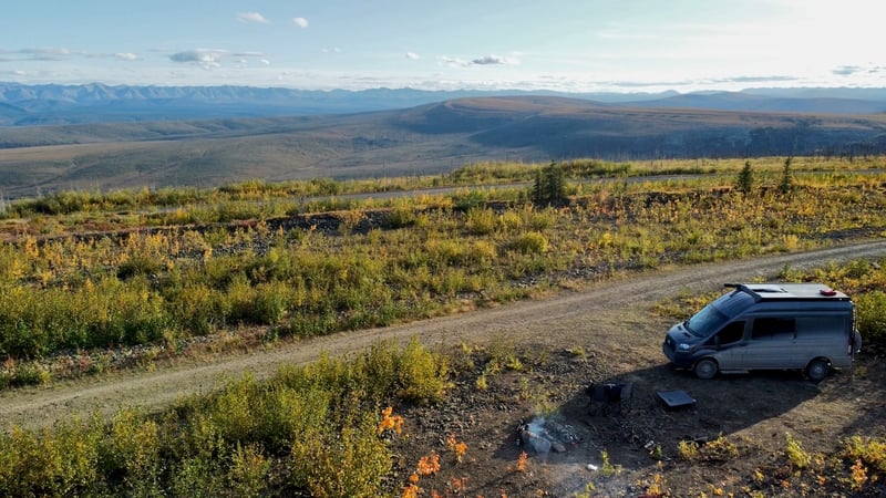
Gravel pits. All along the Dempster there are old extraction sites left over from building the road. You can camp at most of them. They vary a lot — some are nothing special, some have 360-degree views over the mountain ranges. Don’t write them off.
Rock formation pullouts. Just off the highway in a few places, surrounded by interesting geology on all sides. Worth stopping to look before you commit — some are better than others.
The horses spot. Just north of Tombstone, on the Blackstone River flats, there’s a great boondocking area where wild horses sometimes wander through camp. We wrote about our night there.
It’s worth knowing that one side of the road is sometimes indigenous land — the maps should show this, but worth checking as you go. In practice, near the highway people generally just pull off wherever.
These aren’t managed sites. Two things to watch for: the pits were sprayed with dust suppressant chemicals during construction, so be careful if you have kids or pets. Some also have ponds that look benign but are quite deep with steep sides. Worth a look before you let anyone wander.
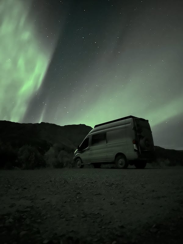
Northern lights
The night skies on the Dempster are as good as it gets in North America — the latitude is right, and there’s no meaningful light pollution anywhere on the route.
Before you leave, bookmark an aurora forecast site and download an app. The Space Weather Prediction Center publishes KP index forecasts; any night with clear skies and a KP above 3 or 4 is worth staying up for. Above 5 and you want to be outside. The Dempster in late August and September will give you enough dark hours to make it count.
At Tombstone we told our camping neighbours to knock on our door if the aurora came up after we’d gone to bed — and we made the same offer the other way. We ended up knocking at 3am. Nobody complained.
Fuel on the Dempster
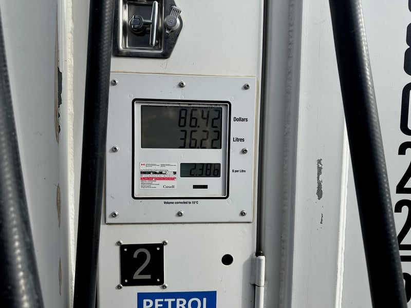
There’s a group called Driving the Dempster that’s worth joining before you leave. People post current fuel availability at each stop, ferry status, and general road conditions. Actually useful.
Fuel stops heading north: Dawson City → Eagle Plains (~360 km) → Fort McPherson (~180 km) → Inuvik (~110 km).
Both Eagle Plains and Fort McPherson fuel up the same way — a shipping container-style station, diesel one side, petrol the other. Fort McPherson’s is on the left before you reach town; Eagle Plains’ is part of the main complex. Neither looks like much.
Eagle Plains is the one to watch on price. They’re reliable — they always seem to have fuel — but it’s genuinely extortionate. Our strategy on the return leg was to buy only enough to comfortably reach Fort McPherson and fill up properly there. On the way up we hadn’t figured this out yet and filled completely, which stung.
General rule: always carry enough to reach the next-but-one stop. That way one dry station doesn’t strand you.
Eagle Plains
Eagle Plains sits roughly halfway along the Dempster. It’s a hotel, a fuel station, a restaurant, and a bar — there’s some industrial infrastructure around it, but don’t expect a town.
The restaurant is fine. The bar works. The taxidermy is impressive.
There’s a story worth asking about: Eagle Plains is where the Great Canadian Manhunt ended, with the fugitive tracked down and shot here. The details are around if you look for them.
Eagle Plains also supposedly issues a certificate of some kind — ask at the desk. The caveat is that this depends entirely on whether the person who knows how to operate the printer is working that day.
One practical note: the manager has a dog that’s not friendly. If you’re travelling with a dog, keep some distance.
The Richardson Mountains
Past Eagle Plains, you cross into the NWT and into the Richardson Mountains — and the landscape jumps. More open, more exposed, noticeably windier. This is also where you can read the difference between glaciated and non-glaciated terrain directly from the shape of the valleys.
Valleys carved by glaciers are U-shaped: wide, flat-bottomed, with steep straight walls where the ice scoured everything clean. Rivers alone carve V-shaped valleys: narrower, pointed at the bottom, with more irregular slopes. Back at Tombstone you were looking at V-valleys — no ice ever got there. The Richardsons were different. The Laurentide Ice Sheet extended along the eastern face of these mountains to roughly 750 metres elevation around 18,000 years ago, and the glacial signature is still legible in the valley profiles. The broader, flatter floors with those abrupt walls are exactly what the ice left.
Watch for Engineer Creek in this NWT stretch. The creek runs visibly rust-red for about five kilometres — iron oxide leaching from oxidising minerals in the bedrock. It’s not subtle. You’ll know it when you see it.
Gravel pit camp: 66°32′N
Just before the Arctic Circle sign there’s a gravel pit with 360-degree views over the surrounding mountains — one of the best boondocking spots on the whole highway. Drop this into your GPS: 66°32’56.7”N 136°20’28.8”W.
The Arctic Circle and Fort McPherson
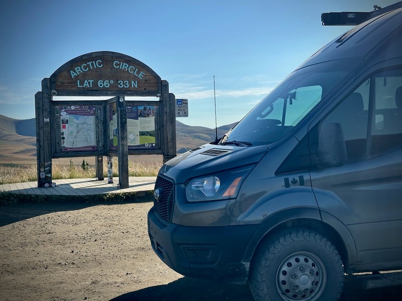
The Dempster crosses the Arctic Circle a little south of Fort McPherson — there’s a sign. Stop and take the picture. The official certificate comes later, from the tourist information centres in Inuvik, but the sign is the moment.
Fort McPherson is a small First Nations community a few kilometres further on. You can get fuel here — the shipping container station is on the left before you reach town proper — and there’s a grocery store, though Inuvik has more options and better prices if you can hold out.
The ferries
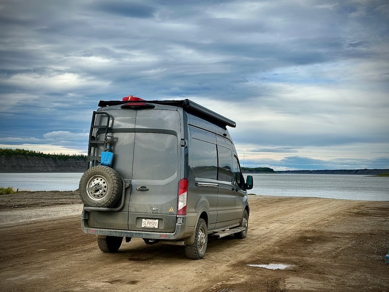
There are two ferry crossings on the Dempster and both are free.
The first is the Peel River crossing — a simple cable ferry, flat barge, back and forth. Quick and uneventful.
The second is the Mackenzie River, a bigger operation with three separate loading points. It’s a real ferry rather than a cable car, and more interesting for it. Both seemed well-run; neither felt sketchy.
If the ferries aren’t running — maintenance, high water, shoulder season — check the Facebook group before you commit to a schedule.
Inuvik
Inuvik is the last real town before Tuktoyaktuk. It’s not large, but after several days of gravel and shipping-container fuel stops, it feels like a metropolis. Stock up here — proper grocery stores, fuel at reasonable prices, and a few tourist information centres that are worth visiting both for the certificates and in their own right.
For camping, we followed iOverlander’s advice and parked near the rec centre. If you’re tidy, keep to yourself, and don’t light a campfire, nobody bothers you. There are also proper boondocking spots nearby if you’d rather have space.
We were parked up in Inuvik when we saw a Cybertruck. Lifted, off-road tires, a spare strapped across the back. Once you get past the revulsion that someone paid money to Elon Musk for the thing, the fact that it had made it to the arctic was genuinely impressive. If a Cybertruck can conquer the Dempster, you almost certainly can too.
The last tree
About three kilometres north of Inuvik, there’s a sign marking the treeline. On one side: the northern edge of the boreal forest — white spruce, poplar, birch, increasingly stunted and wind-battered. On the other side: nothing taller than your knee, all the way to the Arctic Ocean.
Trees need a long enough summer to grow and reproduce. The rule of thumb is a mean July temperature of around 10°C — below that, the growing season is too short and the ground stays frozen too deep for roots to take hold. North of this line you’re in the Barrenlands: tundra, permafrost, lichen, and a horizon that goes on forever. The transition happens in about fifty metres.
Stop at the sign. It’s more than a little eerie.
Tuktoyaktuk
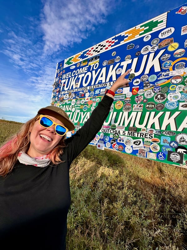
We’d been planning this trip for more than a year. It had started as a cool idea from a YouTube video and slowly became something we actually believed we could do. Cresting the last hill and seeing the lights of Tuktoyaktuk appear out of the tundra was genuinely emotional. We noticed the pingos first, getting more frequent as we got closer, until suddenly there was a town. A pingo is an ice-cored hill: pressurised groundwater migrates through the permafrost, gets trapped, and as it freezes it expands and domes the surface upward into a cone. They can reach 50 metres high. The Tuk area has around 1,400 of them — the largest concentration in the world — because the Mackenzie Delta’s hydrology and the local permafrost create near-perfect conditions for their formation.
Tuk is exactly what you’d expect and also completely surreal. There’s a “Land of the Pingos” sign and an Arctic Ocean sign, both of which exist for the specific purpose of people getting their photo taken in front of them. We did both, obviously.
Camping: There’s paid camping near the Arctic Ocean sign, which is your best bet. Electrical hookup is technically available, delivered via extension cords strung across about fifty metres of tundra. It works. Sort of.
The currents at the main tourist beach are serious and dangerous. For a swim in the Arctic Ocean — and you should — head instead to the beach near the RCMP station. Much safer.
After your swim, go to Grandma’s Kitchen and ask for country food. We had muktuk — beluga whale blubber — and dry fish. Cash only.
The tourist information office hands out certificates — including one for reaching the Arctic Ocean, and possibly one for the Arctic Circle (which you can also pick up in Inuvik if you missed it there).
The drive south
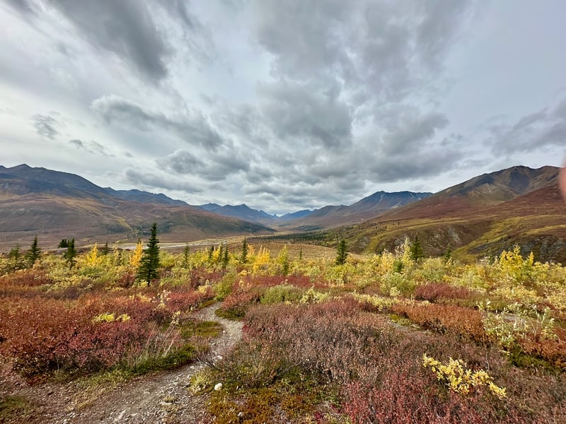
We arrived in Tuk in late August, and the timing turned out to be one of the best decisions we made. The fall colours were already starting on the way north — hints of gold in the willows, a blush of red on the tundra. By the time we were heading south they were in full effect, and by the time we reached Tombstone, every mountain was covered in rich gold and crimson. Arctic tundra turns fast and bright.
If you can give yourself a relaxed return schedule, do it. We essentially got three weeks of peak autumn as we worked our way south, the colours following us down through the elevation and latitude bands. It’s not something you’d get rushing back.
Late August also means the bugs are mostly done. It had been cold enough at night for a few weeks to knock them back — not seriously cold, but toque-in-the-morning cold. Compared to what some people report on the Dempster in July, we barely noticed them.